Introduction: Regional Weather Models
The atmosphere is infinitely complex, with weather phenomena ranging from planetary scales (e.g., El Niño, intertropical convergence zone) to microscopic scales (condensation, heat exchange) and everything in between, including mesoscale (complex storm systems) and synoptic scale (baroclinic disturbances).
To predict its evolution, numerical weather prediction models are used. The resolution of these models determines the minimum spatiotemporal dimensions of phenomena that can be simulated. Global models provide forecasts for the entire planet but typically have a resolution that doesn’t exceed 10 kilometers. This makes it impossible for them to model smaller-scale phenomena such as isolated thunderstorms or local fog.
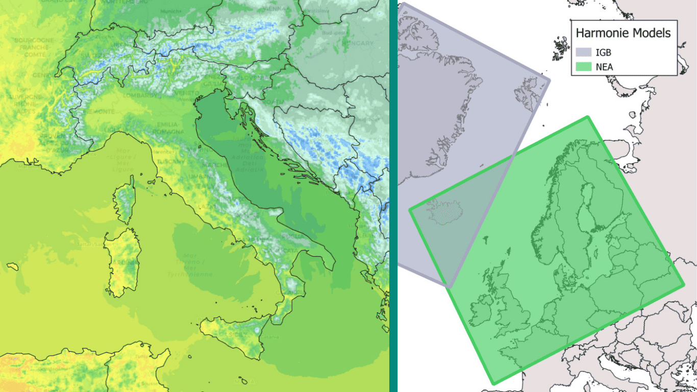
However, there are also regional models that, as their name suggests, simulate atmospheric evolution within a limited domain. Their resolution can be lowered to around a kilometer or even less. Some major meteorological centers worldwide have such models for their regions of interest. For example, there’s the AROME model with a 1.3 or 2.5-kilometer resolution deployed in mainland France and parts of the French overseas territories by Météo France, the ICON-D2 model providing 2-kilometer resolution forecasts over Germany, or the HRRR model at 3 kilometers developed by the NOAA in the United States.
Despite their undeniable contribution to fine-scale weather modeling (Figure 1), setting up and maintaining such atmospheric simulations is complex and costly. That’s why high-resolution models are relatively rare and cover only limited areas of the globe.
The WRF Model
The Weather Research and Forecasting (WRF) model is developed in partnership between the National Oceanic and Atmospheric Administration (NOAA) of the United States, the National Center for Atmospheric Research (NCAR), and over 150 university research centers worldwide. It is widely used for both research applications and by the industry.
Our weather experts can configure and deploy the model over any region of the globe to suit specific climatic conditions, set up simulations at the required spatial resolution and calibrate the model’s physics to optimize the quality of forecasts.
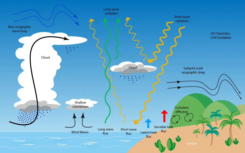
In particular, they can adjust what are known as physical parameterizations, which govern several classes of very small-scale phenomena impossible to capture explicitly by the model. As shown in Figure 2, these parameterizations fall into several categories: radiation-related parameterizations (solar and terrestrial), convection, microphysics, boundary layer, and atmospheric chemistry. Each region and its meteorological specifics correspond to an optimal set of parameterizations.
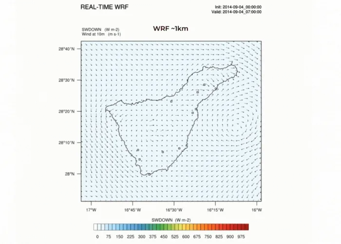
The WRF Model at FROGCAST: Application in French Polynesia
At FROGCAST, the WRF model has been deployed and provides operational forecasts in several areas, especially insular regions. Its forecasts complement the basic multi-models mix.
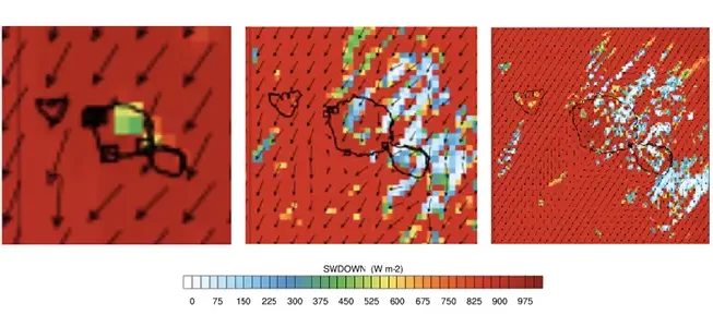
We illustrate here the contributions of WRF simulations in the Tahiti archipelago, where this model has provided forecasts for solar radiation and temperature for over five years. Located in a tropical and isolated area in the middle of the Pacific, this island experiences a humid and warm climate throughout the year. The rainy season extends from November to April with regular and often intense thunderstorm activity. The greatest challenge lies in predicting the initiation, development, and extent of convection, leading to significant variability in weather conditions. The island’s topography also plays an important role in diurnal cloud development and interacts with the trade winds.
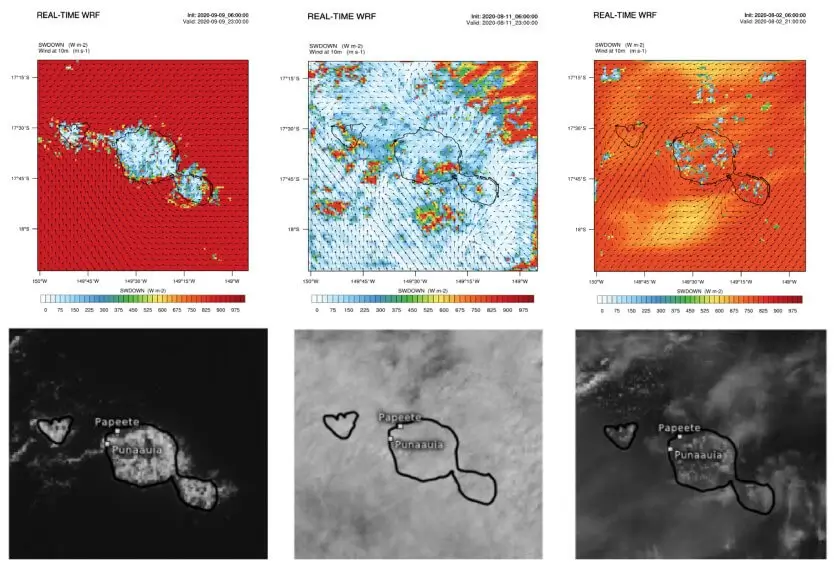
The example below presents solar radiation simulations from the WRF model for three days with very different weather conditions. They are compared to satellite images at the same time. The first day is characterized by cloud development over the terrain due to diurnal evolution, eventually spilling over to the coast. WRF perfectly captures this topographical effect in its simulation. In the second case, a compact cloud mass covers the entire region, with occasional clearings in the north and southwest of the archipelago. Here too, the forecasts are in line with the situation. Finally, in our third example, two cloud layers coexist with a few isolated cumulus clouds overhung by high-altitude cirrus clouds. These two elements are present in the WRF simulation, once again proving its ability to model diverse atmospheric phenomena in terms of physical processes or spatiotemporal scale.
WRF and You
The WRF model can meet the need for fine-scale forecasting for lead times up to 48 hours. It can particularly provide added value in areas where no other high-resolution regional model is available.
Our team of meteorologists can define and deploy the optimal model configuration for your area and your meteorological parameters of interest, ensuring optimal performance. Our modeling expertise allows us to tailor our proposal to your operational specificities, such as generating ensemble forecasts (multi-parameterization or multi-forcing) or considering additional phenomena such as the impact of atmospheric aerosols.
Don’t wait, contact us to discover the capabilities of the WRF model!